
How Deep a Paver Base Should Be, and Why Patios Move
The hardscape industry's minimum is 4 inches of base after compaction for a patio or walkway over well-drained soil and at least 6 inches for a residential driveway, and it states that colder climates over continually wet or weak soils need thicker bases than that. Much of this metro is not well-drained soil, so the minimum is the wrong starting point at a lot of addresses here. Patios move when the subgrade was not compacted to a number, the base was too thin for the ground under it, or water has nowhere to go.
Already know you need someone out? Call (315) 640-3590, answered 24/7.
A paver patio, from the bottom up
Excavation and subgrade
Compacted to at least 98 percent standard ProctorASTM D698. On extremely saturated or very fine soils the specification calls for stabilizing the subgrade instead of pressing on.
Subsurface drainage
Before the base, not after4 inch perforated pipe in at least 3 inches of open-graded stone, wrapped in geotextile, top of stone level with the compacted subgrade, sloped to an outlet.
Base, in lifts
4 inches minimum after compaction, more on wet or weak soilsSpread and compacted in 4 to 6 inch lifts. A residential driveway starts at 6 inches.
Bedding and pavers
Set 1/8 to 1/4 inch highThe specification allows for minor settling on any flexible surface, which is why unit paving can be lifted and reset.
Edge restraint and fall
Minimum 1.5 percent slopeAbout 3/16 inch of fall per foot. Check it with a level before the final payment, not after the first storm.
The order the layers go in, and the number to ask for at each stage.
The number, and where it actually comes from
The hardscape industry publishes its base specification, and it is short enough to check against a quote. Base thickness is determined by traffic, soil type, subgrade soil drainage and moisture, and climate. Sidewalks, patios and pedestrian areas should have a minimum base thickness after compaction of 4 inches over well-drained soils. Residential driveways on well-drained soils should be at least 6 inches. And in colder climates, continually wet or weak soils require that bases be thicker. The 2020 edition of that same technical bulletin put a figure on the adjustment, at least 2 to 4 inches thicker, which would read as 6 to 8 inches under a patio here rather than 4; the current web edition of the bulletin has dropped the number and says only that the base must be thicker, so treat the figure as the older published guidance rather than as today's letter. Either way, two words in that specification do the work: after compaction. Four inches of loose stone is not a 4 inch base, and the two are indistinguishable once the pavers are down.
Well drained is a classification, and your address already has one
The phrase over well-drained soils is not a figure of speech, it is a soil survey class, and the two largest soil map units in Onondaga County sit at opposite ends of it. Honeoye silt loam on 3 to 8 percent slopes covers about 29,876 acres and is classed well drained, hydrologic group B. Niagara silt loam on 0 to 4 percent slopes covers about 23,452 acres and is classed somewhat poorly drained, group C over D. Carlisle muck adds about 9,791 acres of very poorly drained ground. Those are not evenly spread, either. In the Town of Cicero, 59.5 percent of the mapped soil area is classed poorly, somewhat poorly or very poorly drained and only 6.2 percent is well drained, while in the Town of Camillus 57.5 percent is well drained and 14.2 percent is not. A base depth quoted from habit is a base depth quoted for somebody else's town. You can look your own address up in minutes on the NRCS Web Soil Survey without paying anybody, and it is worth doing before your quotes are finalized rather than afterward.
In the northern towns the water table sits inside the excavation
There is a second thing the soil data tells you, and it is the one that catches people out. Niagara silt loam, the second most extensive soil in the county and the dominant soil across the northern towns, carries a seasonal high water table with its top about 31 centimeters down, roughly 12 inches, and the county soil data records that condition for December, January, February, March, April and May. Kendaia silt loam is shallower again, about 20 centimeters or 8 inches. Twelve inches is a patio excavation. So on those soils, for six months of the year including every freezing month, the hole your base sits in is at or below the seasonal water line. That is the mechanism behind a patio that looks fine in September and has moved by April: saturated ground that then freezes, under a base that was designed as if the ground were dry. It is also why a drainage line on a quote in Cicero is not an upsell and why the same line on a well drained slope in Marcellus, where Honeoye's water table sits about 30 inches down, may genuinely not be needed.
Compaction is a number, not a feeling
This is the quietest line item in hardscaping and one of the largest. The specification states that compaction of the soil subgrade is critical to how interlocking concrete paving performs, that adequate compaction will minimize settlement, and that compaction should be at least 98 percent of standard Proctor density as specified in ASTM D698. It adds an honest caveat: that standard may not be achievable in extremely saturated or very fine soils, and stabilizing the subgrade may be necessary in those situations. Two things follow for a homeowner. First, there is a number you can ask for, and asking converts a vague promise about good compaction into a term of the contract. Second, the specification itself anticipates the exact soils a lot of this metro has, and its answer is to stabilize the ground rather than to press on. A crew that tells you your subgrade needs stabilizing on a somewhat poorly drained lot is not inventing work, they are quoting the document.
Lifts, and the fall you cannot see by eye
Two more checkable numbers from the same specification. Base material is to be spread and compacted in 4 to 6 inch lifts using a 7,000 pound-force reversible plate compactor, with thinner lifts required for lighter machines in the 5,000 pound-force range. So a 6 inch base is at least two passes of placing and compacting, not one load tipped in and rolled over. And the finished surface has to drain: slopes should be a minimum of 1.5 percent, which is about 3/16 inch of fall per foot. That is a small enough slope that a patio built dead level looks entirely correct and then holds a sheet of water after every storm, which in this climate means holding ice. Fall is easy to check on a finished job with a level and a straight edge, and it is much easier to check before the final payment than after the first November.
Where the water leaves, which is the line missing from the cheap quote
The specification treats subsurface drainage as part of the design rather than as an extra, and it describes the assembly precisely enough to compare quotes with. Free-standing water saturating the soil should be removed, low wet areas can be stabilized with a layer of crushed stone or cement, and the typical arrangement is a 4 inch perforated drain pipe surrounded by at least 3 inches of No. 57 or similar open-graded stone, wrapped in geotextile, set with the top of the stone level with the compacted subgrade and run around the perimeter of the paved area, sloped and directed to outlets. Drain pipes are recommended in clay soils and other slow draining soils. The specification also makes the economic argument for you: subgrade drainage extends the service life of the paving to the extent that the small additional investment is returned many times over in added years of use. On a lot where more than half the mapped soil drains poorly, a quote with no drainage line on it is a quote for a shallower job than it appears to be, and retrofitting drainage later means lifting the patio you just paid for.
A patio at grade does not carry a frost footing, and that is the point of pavers
This gets confused constantly, so it is worth stating plainly. Unit paving is a flexible surface, designed to move a little at its joints rather than to resist movement as one rigid piece. The specification says so directly: the top of installed pavers may be set 1/8 to 1/4 inch above final elevations to compensate for possible minor settling, and a small amount of settling is typical of all flexible paving. Some settlement is expected, in other words, and anyone who tells you otherwise is selling something that does not exist. What you are actually buying is compaction, base depth and drainage, plus the ability to lift a settled area, correct the base under it and reset the same pavers, which is the one repair a poured surface cannot offer. It also means a patio at ground level is not a foundation and does not need to be taken to frost depth. If a quote describes digging your patio down several feet for frost, ask which structure that is for, because steps tying into the house, pillars and fire features carry footings and a paver field does not.
Nothing gets built on frozen ground, at any price
The hardscape specification's cold weather rule has no conditions attached to it: frozen base material must not be installed, and material must not be placed over a frozen soil subgrade. That is the whole rule. Ground built on while frozen thaws into a void under your patio in spring, and no amount of compaction above it fixes what is missing below. It is the reason a cheap late-winter start date is the one seasonal offer with no defensible version, unlike a late autumn masonry job, which the specification does allow with the right heating and protection. If you are being offered a February start on a patio in this county, the price is not the thing to negotiate.
What to do yourself before anyone quotes
Two things, both cheap. Look your address up on the NRCS Web Soil Survey and write down the map unit name and its drainage class, so that when a contractor says the ground here drains fine you know whether it does. Then dig a test hole in the actual location, about as deep as the excavation will be, and look at it the day after rain. The soil map tells you what the county thinks is under your lawn; the hole tells you what is really there, which on a lot that has been graded, filled or built over may be something else entirely. If water stands in that hole, the drainage is the job and the paving is the finish, and knowing it early can change the design or even the location. When you are ready for prices, send us the rough dimensions, what is there now and what the ground does after rain, and we will put it to licensed, insured hardscape crews who will write a base depth in inches and a drainage detail into the quote.
Sources used in this guide
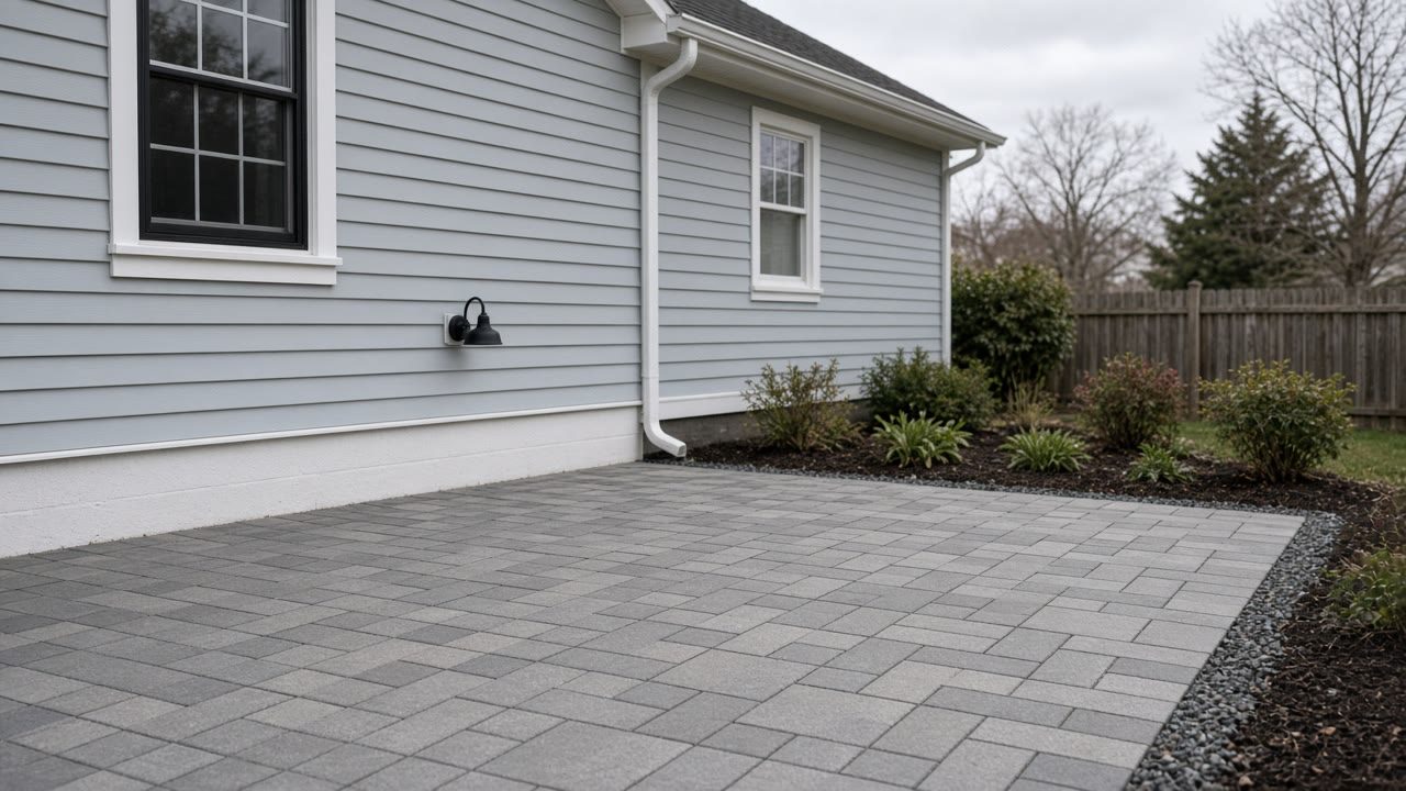
The hardscape industry's own base specification is short and checkable. It states that the thickness of the base is determined by traffic, soil type, subgrade soil drainage and moisture, and climate; that sidewalks, patios and pedestrian areas should have a minimum base thickness after compaction of 4 inches over well-drained soils; that residential driveways on well-drained soils should be at least 6 inches thick; and that in colder climates, continually wet or weak soils will require that bases be thicker.
Source: Concrete Masonry and Hardscapes Association, PAV-TEC-002, Construction of Interlocking Concrete Pavements, accessed 2026-09-14
The 2020 edition of the same technical bulletin put a number on the cold-and-wet adjustment: in colder climates, continually wet or weak soils will require that bases be at least 2 to 4 inches thicker. Applied to the base minimums, that means a patio over continually wet soil in a freeze-thaw climate wants 6 to 8 inches of compacted base rather than 4, and a driveway 8 to 12 inches rather than 6.
Source: Interlocking Concrete Pavement Institute, Tech Spec 2, Construction of Interlocking Concrete Pavements, revised February 2020, accessed 2026-09-14
Compaction is a measurable number, not a matter of judgment. The specification states that compaction of the soil subgrade is critical to the performance of interlocking concrete pavements, that adequate compaction will minimize settlement, and that compaction should be at least 98 percent of standard Proctor density as specified in ASTM D698. It adds that this compaction standard may not be achievable in extremely saturated or very fine soils and that stabilization of the soil subgrade may be necessary in those situations.
Source: Concrete Masonry and Hardscapes Association, PAV-TEC-002, Construction of Interlocking Concrete Pavements, accessed 2026-09-14
Two further numbers from the same document. Base material is to be spread and compacted in 4 to 6 inch lifts using a 7,000 pound-force reversible plate compactor, with thinner lifts required for compactors in the 5,000 pound-force range. And the finished surface must drain: slopes should be a minimum of 1.5 percent.
Source: Concrete Masonry and Hardscapes Association, PAV-TEC-002, Construction of Interlocking Concrete Pavements, accessed 2026-09-14
The specification treats subsurface drainage as a design item rather than an extra. It states that free-standing water saturating the soil should be removed, that low wet areas can be stabilized with a layer of crushed stone or cement, and that a typical assembly is a 4 inch diameter perforated drainage pipe surrounded by a minimum 3 inch of No. 57 or similar open-graded stone, wrapped in geotextile, set with the top of the stone even with the compacted subgrade and run along the pavement perimeter to remove excess water from the subgrade and base, sloped and directed to outlets. It states that drain pipes are recommended in clay soils or other slow draining soils, and that subgrade drainage extends pavement performance to the extent that the small additional investment is returned many times in additional pavement service years.
Source: Concrete Masonry and Hardscapes Association, PAV-TEC-002, Construction of Interlocking Concrete Pavements, accessed 2026-09-14
Unit paving is a flexible pavement and it is designed to move. The specification notes that the top of installed pavers may be set 1/8 to 1/4 inch above the final elevations to compensate for possible minor settling, and states directly that a small amount of settling is typical of all flexible pavements.
Source: Concrete Masonry and Hardscapes Association, PAV-TEC-002, Construction of Interlocking Concrete Pavements, accessed 2026-09-14
The hardscape specification carries its own cold weather rule, and it is absolute: frozen base material should not be installed, nor should material be placed over a frozen soil subgrade.
Source: Concrete Masonry and Hardscapes Association, PAV-TEC-002, Construction of Interlocking Concrete Pavements, accessed 2026-09-14
The two largest soil map units in Onondaga County pull in opposite directions for a hardscape base. Honeoye silt loam on 3 to 8 percent slopes covers about 29,876 acres and is classed well drained, hydrologic group B. Niagara silt loam on 0 to 4 percent slopes covers about 23,452 acres and is classed somewhat poorly drained, hydrologic group C over D. Honeoye silt loam on 8 to 15 percent slopes adds about 21,772 acres of well drained ground, Collamer silt loam on 2 to 6 percent slopes about 13,303 acres of moderately well drained, and Carlisle muck about 9,791 acres of very poorly drained.
Source: United States Department of Agriculture, Natural Resources Conservation Service, Soil Survey Geographic Database for Onondaga County New York, survey area NY067, queried through the Soil Data Access service, accessed 2026-09-14
Niagara silt loam, the second most extensive soil in Onondaga County and the dominant soil across the northern towns, carries a seasonal high water table with its top at about 31 centimeters, roughly 12 inches, below the surface, and the county soil data records that condition for December, January, February, March, April and May. Rhinebeck silt loam has the same 31 centimeter figure. Kendaia silt loam is shallower at about 20 centimeters, roughly 8 inches. For comparison, Collamer silt loam is about 54 centimeters, roughly 21 inches, and Honeoye silt loam about 76 centimeters, roughly 30 inches.
Source: United States Department of Agriculture, Natural Resources Conservation Service, Soil Survey Geographic Database for Onondaga County New York, survey area NY067, queried through the Soil Data Access service, accessed 2026-09-14
In the Town of Cicero, 59.5 percent of the mapped soil area is classed poorly drained, somewhat poorly drained or very poorly drained, and 6.2 percent is classed well drained. The single largest map unit is Niagara silt loam on 0 to 4 percent slopes at about 28.6 percent of the town, followed by Collamer silt loam at about 12.2 percent and Carlisle muck, a very poorly drained organic soil, at about 12.0 percent.
Source: United States Department of Agriculture, Natural Resources Conservation Service, Soil Survey Geographic Database for Onondaga County New York, survey area NY067, queried through the Soil Data Access service, accessed 2026-09-14
In the Town of Camillus, 14.2 percent of the mapped soil area is classed poorly drained, somewhat poorly drained or very poorly drained, and 57.5 percent is classed well drained. The dominant soils are well drained glacial till: Ontario gravelly loam on 8 to 15 percent slopes at about 9.7 percent, Ontario loam on 3 to 8 percent slopes at about 9.6 percent, Camillus silt loam on 2 to 6 percent slopes at about 6.6 percent and Ontario and Madrid soils on 15 to 25 percent slopes at about 6.5 percent.
Source: United States Department of Agriculture, Natural Resources Conservation Service, Soil Survey Geographic Database for Onondaga County New York, survey area NY067, queried through the Soil Data Access service, accessed 2026-09-14
In the Town of Marcellus, 10.6 percent of the mapped soil area is classed poorly drained, somewhat poorly drained or very poorly drained, and 61.9 percent is classed well drained. Honeoye silt loam accounts for about 25.2 percent of the town on 3 to 8 percent slopes and about 12.5 percent on 8 to 15 percent slopes, with Lima silt loam at about 7.6 percent. Honeoye is well drained hydrologic group B with a seasonal water table about 30 inches down.
Source: United States Department of Agriculture, Natural Resources Conservation Service, Soil Survey Geographic Database for Onondaga County New York, survey area NY067, queried through the Soil Data Access service, accessed 2026-09-14
Services this guide relates to
Need someone to look at it?
Send the details and we will come back to you.